

Urban planners across the U.S. are increasingly drawn to the idea of the 15-minute city — walkable neighborhoods where residents can access work, groceries, transit, parks, healthcare, and community services within a short stroll. It’s a compelling vision, and for good reason. Cities want safer streets, lower emissions, and more connected communities. But there’s a missing layer in most conversations: none of this works unless cities can see what’s happening in real time.
A 15-minute city only functions when traffic, safety, mobility, and energy systems react instantly. That means cities need something far more important than redesigned streets — they need a digital brain that processes and responds to activity in seconds, not weeks.
This is where real-time data becomes the difference between theory and reality.
Designing for Walkability Requires Live Mobility Awareness
Walkable neighborhoods depend on predictable, comfortable movement. But mobility patterns shift every hour based on weather, events, school schedules, transit delays, or construction. A static report can’t tell a city when a crosswalk is overwhelmed at 8:15 a.m., or when a park becomes unexpectedly busy after work. Real-time data can.
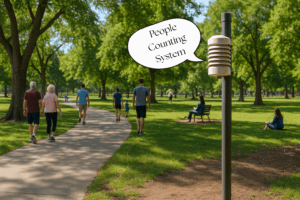
Cities that monitor foot traffic, trail activity, and street usage minute by minute understand exactly where people are moving and how their environment should adapt. This allows transportation teams to adjust signal timing, direct users to safer routes, or respond quickly when a surge in visitors puts pressure on public spaces. The 15-minute model isn’t just about shorter distances — it’s about smoother movement, and that only comes from instant insight.
Local Safety Depends on Updates Faster Than a Human Can Report
The promise of the 15-minute city includes safer streets, better lighting, and reduced emergency response times. But traditional safety systems rely on manual reporting or delayed alerts, which leaves gaps at precisely the wrong moment. Real-time sensing changes that dynamic.
When sensors detect unexpected motion after hours, activity spikes in sensitive areas, or unusual patterns around public infrastructure, alerts reach teams instantly. This allows parks and public safety departments to intervene early, preventing small issues from escalating. Safety in compact neighborhoods must be proactive rather than reactive — and proactive systems are built on live data streams.
Energy Efficiency Works Only When Systems Respond Instantly
Walkable districts rely on consistent comfort: lighting that supports evening movement, shaded areas that keep temperatures manageable, and well-maintained public amenities. Many cities set schedules for lighting, watering, or HVAC use based on averages rather than present conditions. The result is wasted energy and inconsistent user experience.
Real-time environmental sensing solves this by allowing systems to respond to what’s happening right now. Pathways brighten when people approach. Irrigation adjusts automatically based on soil moisture. Facilities adapt energy use to occupancy. These micro-adjustments add up to major savings — the kind of efficiency a true 15-minute city requires.
Transit and Parking Need Second-by-Second Awareness
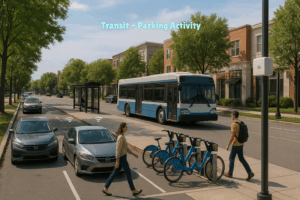
Even in compact neighborhoods, people rely on shared mobility — public transit, bikes, scooters, or short parking durations. Real-time data helps cities smooth mobility across these networks. Parking availability updates based on actual occupancy. Sensors track pedestrian flow during peak hours. Transit nodes adjust to shifts in nearby activity.
Without real-time updates, mobility becomes guesswork, and guesswork breaks the rhythm of a neighborhood meant to move effortlessly.
The Hidden Challenge: Siloed Dashboards Slow Cities Down
Many cities already collect data but in separate dashboards that don’t communicate with each other. Traffic has one system. Parks have another. Safety teams have a third. The result is a collection of insights that are individually useful but collectively ineffective.
A 15-minute city needs synchronized intelligence, where mobility, environment, lighting, and safety work as one ecosystem. For that, cities require platforms capable of merging multiple data streams into a single, live view. Not once a day. Not once an hour. Constantly.
This is what turns vision into reality.
Where Varidx Fits In
Varidx gives cities the ability to see and respond to what’s happening in their neighborhoods as it happens. Our platform brings together footfall activity, environmental conditions, safety signals, transit patterns, and energy data into a single, real-time interface.
Cities can monitor park activity, adjust lighting as visitors move, respond quickly to unusual motion in sensitive areas, track water levels during storms, and understand mobility across entire districts — all without juggling multiple dashboards.
This is the “1-second brain” a 15-minute city needs: a unified system that processes signals instantly and helps every department make better decisions with less friction.
Varidx isn’t about predicting the future. It’s about giving cities the clarity to shape it — one second at a time.