
Part of Smart parks & recreational centers
Flood monitoring and early warning
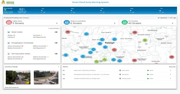
The Varidx Smart Flood Early Warning System (SFEWS) gives local governments real-time updates on water levels, precipitation and soil saturation at the places that flood: creeks, storm drains, culverts, underpasses and intersections. Camera feeds confirm conditions visually, and street-specific alerts help teams close roads, warn residents and send crews where they are needed.
Key highlights
- Street-level dataSensors are placed at flood-prone intersections, culverts and neighborhoods, not only at riverside gauges.
- Camera verificationLive camera feeds let teams confirm flooding visually before they respond.
- ForecastingModels combine sensor data with historical flood behavior and weather forecasts to predict where flooding will occur next.
How it works
- Sensors — Track water levels, rainfall rates and soil saturation at critical points.
- Analysis — The platform processes sensor data with historical flood behavior and weather forecasts.
- Dashboard — Emergency and public works teams monitor conditions in real time and see clear, fast-to-read alerts.
- Automation — Street signs, gates, mobile apps and emails can be triggered automatically during an emergency.
Planning for resilience
Long-term water level records show which roads and neighborhoods flood repeatedly, helping cities decide where to invest in drainage and stormwater improvements.
See how this works in Morrisville, NC
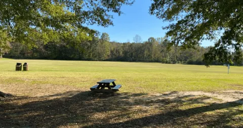
Cedar Fork District Park
Morrisville, North Carolina
Field status, flood and soil moisture monitoring, with open and closed status shown at the park gate.